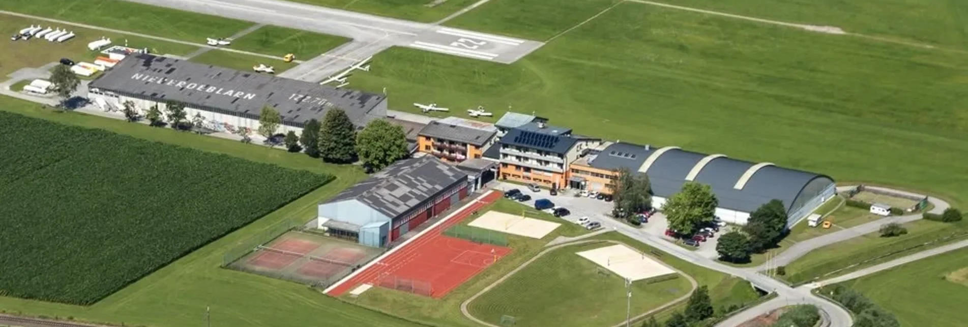
Winter Hiking Niederöblarner Teichrunde - Touren-Impression #1 Winter Hiking Niederöblarner Teichrunde - Touren-Impression #1

Niederöblarner Teichrunde

Winter walk on a flat hiking trail

Starting from the Sportsarea Grimming in Niederöblarn, you head into the Ennsau. You take a leisurely stroll along the flat hiking trail around the Niederöblarn pond in the direction of the airfield and along the dirt track back to the Sporsarea access road.

Characteristics

Skill
Fitness

Best season

The tour in numbers

2,0 km
Route
0:30 h
Time

Map & downloads

More information

In Espang, turn off the B320 Ennstalbundesstraße onto the L734 main road. Drive two kilometres to Niederöblarn, then turn right to the Sportsarea Grimming.

Starting from the Sportsarea Grimming in Niederöblarn, you head into the Ennsau. You take a leisurely stroll along the flat hiking trail around the Niederöblarn pond in the direction of the airfield and along the dirt track back to the Sporsarea access road.

Public parking lots opposite of Grimmingtor inn.

Winter Experience Map Schladming-Dachstein "OST", available at the tourist offices in the region.

Gallery

Nearby accommodation options

Continue to search

You may also be interested in

Recommended tours

Die Walchental-Runde startet in Öblarn | Christoph Lukas | © Erlebnisregion Schladming-Dachstein
Schladming-Dachstein
Route 10,8 km
Duration 3:00 h

Winter Hiking Path to Walchental

winterwanderung zur grimminghütte_img_54753307 | © Erlebnisregion Schladming-Dachstein
Schladming-Dachstein
Route 6,2 km
Duration 2:15 h

Winter hike to the Grimminghütte

Zu Beginn der Wanderung entlang des Donnersbachs | © Erlebnisregion Schladming-Dachstein
Donnersbach
Route 7,2 km
Duration 2:00 h

Winter hiking on the Raumbergweg

krapflhof runde_img_56098524 | Christoph Lukas | © Erlebnisregion Schladming-Dachstein
Schladming-Dachstein
Route 5,8 km
Duration 2:00 h

Winter hike Krapflhof Runde

Winter in Tauplitz | TVB Ausseerland-Salzkammergut_Tom Lamm | © Ausseerland
Ausseerland-Salzkammergut
Route 4,5 km
Duration 1:10 h

Winter hiking trail in the village of Tauplitz

Eislaufplatz | © Tourismusverband Ausseerland-Salzkammergut/S. Zink
Ausseerland-Salzkammergut
Route 7,4 km
Duration 2:00 h

Winter hike Bad Mitterndorf

Winterwandern am Mitterberg - mit Ausblick zu Kammspitz und Stoder | Gemeinde Mitterberg-Sankt Martin | © Erlebnisregion Schladming-Dachstein
Schladming-Dachstein
Route 16,1 km
Duration 4:15 h

Winter hiking trail Mitterberg