Hiking route Wöllmißberg tavern gala - Touren-Impression #1 | © Region Graz Hiking route Wöllmißberg tavern gala - Touren-Impression #1 | © Region Graz

Wöllmißberg tavern gala

What could be better than combining hiking with a visit to a wine tavern? We have exactly this opportunity twice at the Wöllmißberger Buschenschank-Gaudi.
This Buschenschank circular trail shows a typical form of hospitality in Styria: the Buschenschänke. This is characterized by the fact that homemade regional dishes are at the top of the menu.

Let's hike through the idyllic region around St. Martin am Wöllmißberg and get to know the Styrian rucksack villages from this side.


Characteristics

Skill
Fitness

Best season

January
February
March
April
October
November
December

The tour in numbers

medium
Level of difficulty
8,2 km
Route
2:30 h
Time
268 hm
Uphill
268 hm
Downhill
776 m
Highest point

Map & downloads

More information

Von Wien/Graz über Autobahn A2 Abfahrt Mooskirchen, weiter über Gaisfeld und Gößnitzgraben bzw. Köflach nach St. Martin am Wöllmißberg. Von Klagenfurt über Autobahn A2 Abfahrt Modriach, an der Kreuzung Stampf nach Edelschrott und weiter nach St. Martin am Wöllmißberg.
 
Our hiking trail begins in the village center of St. Martin am Wöllmißberg. From here, we first walk about 350m to the south-east and then continue on the municipal road in a north-easterly direction until we reach the Wendlkapelle chapel (= the first chapel). Here we turn right and follow the signs to Buschenschank Münzer vulgo Haas, which is our first refreshment stop.

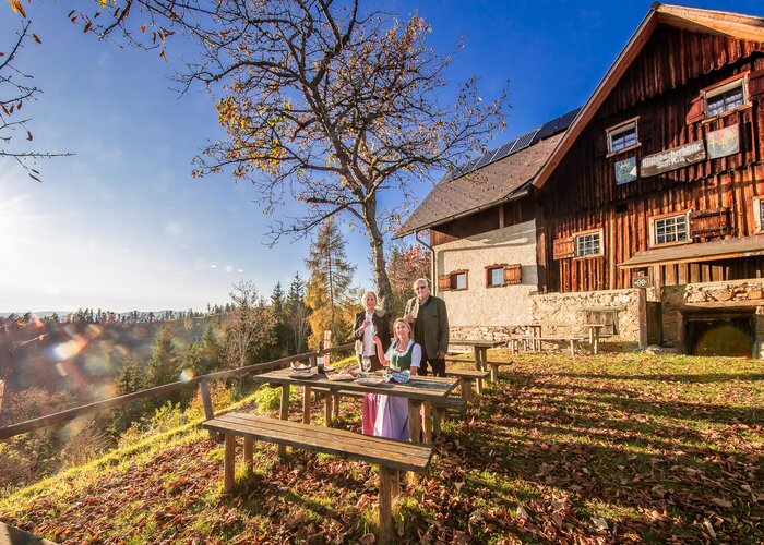
After a leisurely rest and some good food, we walk across gently sloping meadow and forest terrain to Grötschbach. Through a high forest on its southern side, we reach the Tischlerweber chapel, which is located directly on the slightly ascending municipal road that leads in a south-westerly direction to the Buschenschank Formeier vulgo Jauk. On our second intermediate stage, we can once again enjoy culinary delights from the Lipizzaner region.

The way back to St. Martin leads us in a south-westerly direction on the asphalt road to the L 346. At this junction, we turn right and after a short time return to the starting point of our hike.


Wöllmißberger Heimatmuseum

 
Eine Anreise mit öffentlichen Verkehrsmitteln ist leider nicht möglich.
 
Es stehen ausreichend Parkplätze zur Verfügung
 
Tourismusverband Region Graz

Messeplatz 1/Messeturm

8010 Graz

T +43 316 8075-0

info@regiongraz.at

www.regiongraz.at

Wanderatlas der Steirischen Rucksackdörfer
 

Gallery

Nearby accommodation options

Continue to search

You may also be interested in

Recommended tours

Accessible by public transport
Eine perfekte Wegmarkierung als Wegbegleiter | Harry Schiffer | © (c) Steiermark Tourismus/Harry Schiffer
Region Graz medium Open
Route 19,8 km
Duration 6:30 h

Stage 17 From Glacier to Wine South Route Pack - Weinebene

Accessible by public transport
Piberer Hügellandschaft | Die Abbilderei | © Lipizzanerheimat
Köflach easy
Route 6,1 km
Duration 2:00 h

Conversano Rundweg

Accessible by public transport
Hebalm | Katrin Schwarz | © Community
Bezirk Voitsberg medium
Route 6,7 km
Duration 2:30 h

Winkelwanderung: Von Modriach-Winkel auf die Hebalm

Accessible by public transport
Lipizzaner | Enrico Caracciolo | © Region Graz
Köflach medium
Route 11,1 km
Duration 3:00 h

Maestoso circular hike

Accessible by public transport
Altarraum der St. Barbara Kirche Hundertwasser | Harry Schiffer | © Steiermark Tourismus
Bärnbach easy
Route 8,6 km
Duration 2:30 h

Wanderung rund um das Lipizzanergestüt Piber (8)

Accessible by public transport
Packer Geopark | Robert Cescutti | © Berg- und Naturwacht
Edelschrott medium
Route 13,4 km
Duration 4:30 h

Packer Naturerlebnis

Accessible by public transport
Blick auf Stallhofen | Franz Moitz | © ÖAV Ortsgruppe Stallhofen
Stallhofen challenging
Route 35,4 km
Duration 10:00 h

Stallhofner Rundweg