
Weißeck round
This is a moderately difficult hiking tour, with wonderful viewpoints and great landscape panoramas.
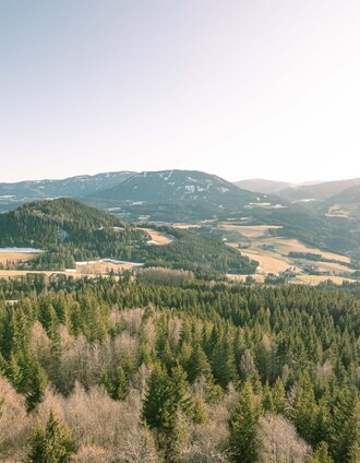
This hiking route is a tour that should not be underestimated. In this regard, a certain level of fitness and endurance is required. However, once you reach the summit, all your efforts are rewarded by a fantastic panoramic view!
Characteristics
Best season
January
February
March
April
May
June
July
August
September
October
November
December
The tour in numbers
easy
Level of difficulty
17,7 km
Route
6:00 h
Time
983 hm
Uphill
983 hm
Downhill
1741 m
Highest point
Map & downloads
More information
By car from GermanyFrom Munich via the A8 towards Salzburg. From Salzburg on the A10 Tauernautobahn to St. Michael im Lungau. On the B 96 to Tamsweg, then on the B 95 to Predlitz. The B 97 leads via Stadl/Mur to Murau. At the roundabout go straight ahead towards Teufenbach/Scheifling.
Arrival from EasternAustria/HungaryAt the motorway junction in St. Michael near Leoben, take the S 36 towards Klagenfurt. Past Knittelfeld and Judenburg to Scheifling.
Arrival from southernAustria/ItalyVia Klagenfurt on the S 37 past St. Veit/Glan, Treibach and Friesach. In Friesach continue towards Vienna, via Dürnstein and Wildbad towards Neumarkt. Keep left in Neumarkt. You reach Scheifling via the Perchauer Sattel.
The path leads directly from Scheifling's main square past the local history and pipe museum along the panoramic road to the north. At the first crossing of the path, turn right and walk along the path until you reach the Almbauernweg. Follow the signs until you reach the summit.
If you make your way back, you hike down the back of the summit and keep to the right. After a steep left curve, you walk past the Kirchmoarhütte back onto the Almbauernweg. The descent route then follows the already known ascent route.
Back at the starting point, the community of Scheifling can be discovered with its diverse experiences.
With the BusBahnBim app from the interconnected line, timetable information is easier than ever before: all bus, train and tram connections in Austria can be queried by entering locations and/or addresses, stops or important points. The app is available as a free app for smartphones (Android, iOS) - on Google Play and in the App Store.
ÖBB www.oebb.at | Styria connection line www.busbahnbim.at
Public parking spaces are available directly on the main square.
The ideal time for this tour is from May to October. Information brochures are available at the various information offices.


